It may be a snowy start to Saturday for parts of Nova Scotia. A northerly wind keeps a bitter wind chill in place across the Maritimes.
Snow for parts of N.S. Friday night into Saturday
A low-pressure system exiting the northeastern Unites States will pass just to the south of Nova Scotia Friday night into Saturday morning.
The system is expected to get close enough to swipe western areas of the province with snow that may come down heavy at times into early Saturday morning.
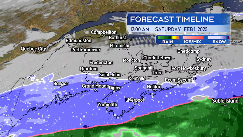
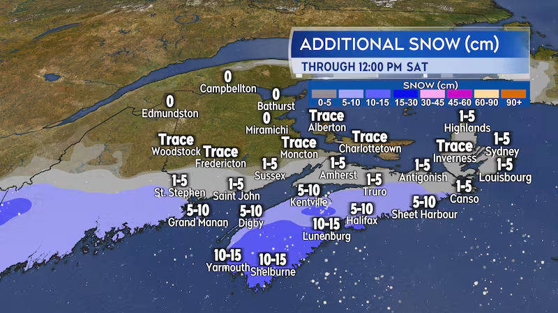
The Tri-County area (Digby/Yarmouth/Shelburne) and South Shore should be prepared to wake up to 10-to-15 cm of snow Saturday morning. Halifax and the Annapolis Valley starting the day with having to clear five-to-10 centimetres of snow. The remainder of Nova Scotia will likely pick up amounts of one-to-five centimetres.
The system misses most of New Brunswick and Prince Edward Island. The southwestern islands of New Brunswick, Campobello/Grand Manan/White Head, could pick up five-to-15 cm of snow tonight into Saturday morning.
Extreme cold warning for northern N.B.
A developing northerly wind will keep temperatures very cold for the Maritimes this weekend.
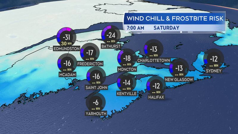
Temperatures in northern New Brunswick are expected to be well down into the minus 20s early Saturday morning. The gusty wind creating a wind chill that could make it feel between -30 and -35. Environment Canada issued an extreme cold warning for the regions expected to be impacted by that more severe wind chill.
The remainder of the Maritimes should expect to contend with a wind chill making it feel between -14 and -22 Saturday morning.
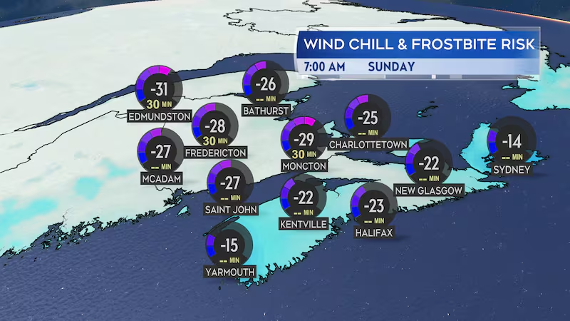
Temperatures get even colder Saturday night into Sunday morning. I would expect a wind chill making it feel into the minus 30s for northern areas of New Brunswick Sunday morning. A wind chill making it feel into the minus 20s for much of the rest of the Maritimes Sunday morning.
Temperatures moderate on Monday with the arrival of another low-pressure system that will bring a mix of snow and rain to the region.